


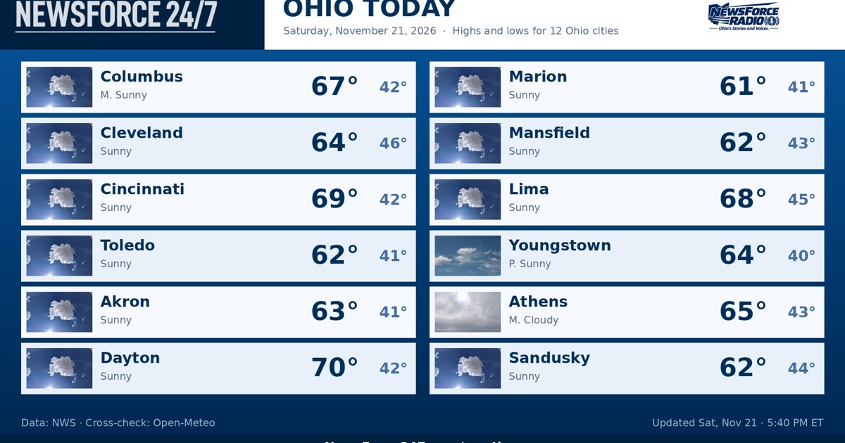
Ohio settles into a clear, cool night on Saturday, November 21, 2026, and the overnight hours are the calm before a busy weather week. The National Weather Service offices serving Ohio reported no watches, warnings or advisories in effect anywhere in the state on Saturday night, and high pressure keeps skies mostly clear to partly cloudy statewide overnight, with lows falling into the low to middle 40s. Columbus was fair and near 51 degrees late Saturday evening and was headed for an overnight low around 42 degrees, a wide day-to-night swing that forecasters in Wilmington tied to very dry air, with dewpoints in the 30s.
Sunday, November 22, 2026, is the last warm day of this stretch, and Ohioans with outdoor or travel plans should treat it that way. Sunshine and mostly sunny skies return statewide on Sunday, with highs in the middle to upper 60s — Columbus near 68 degrees — before clouds build late in the day. The Weather Service in Cleveland put it plainly in its Saturday afternoon discussion: two more days of dry and above-normal temperatures, counting Saturday, and then a cold front Sunday night ends it.

Region by region overnight, northwest Ohio — Toledo, Findlay and Lima — stays clear to partly cloudy with lows in the low to middle 40s, then warms into the middle 60s on Sunday. Northeast Ohio, from Cleveland and Akron to Youngstown, sees a partly cloudy night with lows in the low to middle 40s and Sunday highs in the low to middle 60s. On Lake Erie, the Weather Service in Cleveland said offshore winds around 10 knots and nearshore waves under 2 feet continue tonight and through Sunday, the last quiet stretch on the lake for a few days.
Central Ohio, including Columbus and Marion, is mostly clear overnight with lows in the low 40s, then mostly sunny and warm on Sunday. Southwest Ohio — Cincinnati, Dayton and Wilmington — follows the same pattern, cool tonight with lows in the middle 40s and highs in the middle to upper 60s on Sunday. Southeast Ohio and the Ohio River counties stay dry and cool tonight and dry and warm on Sunday, with clouds increasing later in the day as the front approaches from the west.

The front itself crosses Ohio late Sunday into Sunday night with scattered rain showers. It is not a heavy rainmaker: the Weather Service in Cleveland said the front has slowed in the forecast models and is now an early Sunday night feature, with rainfall generally less than a tenth of an inch, and forecasters in Wilmington likewise expected a tenth of an inch or less at most locations because the system moves through quickly without drawing in much moisture. Roads could be briefly wet Sunday night, but no flooding is expected.
Behind the front, the change is sharp. A Canadian air mass builds in for Monday, November 23, 2026, with highs falling into the 40s statewide — roughly 15 to 20 degrees colder than Sunday — and lows Monday night dropping into the upper 20s and low 30s, the coldest night of the season so far for many communities. On Lake Erie, winds turn northwesterly at 20 to 25 knots Sunday night behind the front, waves build rapidly to 5 to 7 feet through Monday night, and the Weather Service in Cleveland said a Small Craft Advisory is likely.
Looking into Thanksgiving week, the colder pattern holds, and the next chance for precipitation develops Wednesday, November 25, 2026, and continues into Thursday. Forecasters in Wilmington said a low pressure system to the south and a digging system approaching from the northwest could phase together, and depending on how quickly that happens, some wet snowflakes could mix in. Anyone traveling for the holiday should keep an eye on that midweek forecast as it firms up, while tonight and Sunday remain quiet, dry and safe for travel across Ohio.